共找到2條詞條名為趙永超的結果 展開
- 舉重運動員
- 中國科學院副研究員
趙永超
中國科學院副研究員
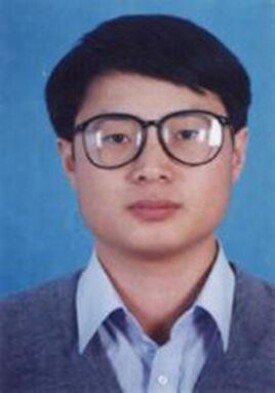
趙永超,男,漢族,浙江諸暨人,博士學位,副研究員。現任職於中國科學院遙感應用研究所。
2003-2004 副研究員,中科院遙感應用研究所,遙感科學國家重點實驗室,高光譜遙感
![趙永超[中國科學院副研究員]](https://i1.twwiki.net/cover/w200/m8/2/m8276baf091d94fe8fcb4b252ddf5f1f5.jpg)
趙永超[中國科學院副研究員]
1994-1999 獲博士學位,北京大學地質學系,岩石、礦物、礦床學專業
1990-1994 獲學士學位,北京大學地質學系,岩礦地化專業
1989-1990 北京大學化學系, 石家莊陸軍學院
高光譜圖像處理: 定標、預處理及優化
典型地物目標的光譜特性研究, 包括典型的農作物、城市人造建材以及礦物/岩石
這些典型地物目標的綜合視反射率光譜的模型化或模擬
基於目標光譜特徵精細理解的高光譜圖像信息提取
高光譜遙感農業和地質應用中的要求問題
趙永超,承繼承等,地物波譜中的不確定性問題-關於“同物異譜”和“異物同譜”的認識,遙感學報,7(增):80-90,2003
Y. Zhao, Q. Tong, et al., "Hyperspectral Remote Sensing Monitoring on Hot Wastewater of Futtsu Power Plant in Tokyo Bay, Japan, by Using Airborne Operational Modular Imaging Spectrometer (OMIS)", SPIE: The 3rd International Asia-Pacific Environmental Remote Sensing symposium 2002
Y. Zhao, X. Zhang, Q. Tong, B. Zhang, L. Zheng, "New Vegetation Models for Hyperspectral Remote Sensing", In: Progress of Agricultural Information Technology, ed. C. Zhao, International Academic Publishers, Beijing, pp.294-300, 2000
Y. Zhao, Q. Tong, L. Zheng, et al., "Discussion on the Requirement of VNIR Hyperspectral Data for Agricultural Applications According to PHI data and CSAM model", Proceeding of the 5th International Airborne Remote Sensing Conference and Exhibition, San Francisco, California, 17-20 September, 2001. (Poster, accepted and in publishing)
Y. Zhao, Q. Tong, L. Zheng, B. Zhang, "A Kernel Adaptive Filter (SRSSHF) and Quality Improvement Method for Hyperspectral Image on the Base of Spectral Dimension Recognition and Spatial Dimension Smoothing According to CSAM", Proceeding of SPIE: SPIE 2nd International Symposium on Multispectral Image Processing and Pattern Recognition , 2001(Accepted)
Y. Zhao, Q. Tong, L. Zheng, "Study on Mineral Exploration by Using MAIS Hyperspectral Data in Tengchong Multi-metal Mining District of China". Proceeding of the 14th International Conference on Applied Geologic Remote Sensing. 6-8 November, Las Vegas, pp. 621, 2000(Poster)
Q. Tong, Y. Zhao, X. Zhang, B. Zhang, L. Zheng, "New Progress in Study on Vegetation Models for Hyperspectral Remote Sensing", Proceeding of SPIE, vol. 4151, pp.153-152, 2000
Q. Tan, Y. Zhao, Q. Tong, "Vegetation Spectral Feature Extraction Model", Remote Sensing Information (in Chinese), 2001.1, pp.14-18.
Y. Cheng, Y. Zhao, "Geochemical Characteristics and Evolution of REE in the Early Precambrian Sediments: Evidence from the Southern Margin of the North China Craton. Episodes, vol. 22(2), pp.109-116, 1997
² "基於POS或IMU/DGPS系統的PHI和OMIS高光譜圖像幾何糾正技術", 2003
² "植被光譜分析",2000
² "關於常州植被光譜的一個新的相關擬合分析模型(CSAM)及其啟示", 2000
² "水稻的綜合視光譜模型(IARS)及常州植被的光譜特徵研究", 2000
² "小湯山高光譜遙感精準農業應用實驗(2001):航空OMIS和PHI高光譜數據獲取和地面工作介紹". 2001
² "新疆喀什-葉城一帶沉積岩VNIR-SWIR光譜特徵分析:正態吸收帶分解模型(NASM)介紹"., 2000
Ø OMIS和PHI圖像預處理系統. (基於 C/C++ 和IDL/ENVI兩個版本), 包括利用機載GPS和穩定平台參數進行幾何糾正和鑲嵌,利用IMU/DGPS或POS系統的無穩定平台圖像幾何糾正等
Ø ASD光譜儀等通用地面光譜測量數據處理和分析系統,能快速多功能地大量處理地面實測光譜.
Ø CSAM和IARS模型軟體: 能用於特定目標的分類和識別
Ø NASM分析程序: 礦物、岩石、植被光譜基本吸收帶的精細分解和分析
Ø SRSSHF處理 工具: 一個很有效的高光譜數據優化方法
Ø CCD相機地面成像時的通用處理演演算法(輻射糾正)及軟體
相關擬合分析模型(CSAM): 用於光譜分析,高光譜數據處理
水稻的綜合視光譜分析模型 (IARS): 用於高光譜圖像中水稻信息提取
正態吸收帶分解模型(NASM): 用於光譜分析
基於光譜維判斷空間維光滑的自適應高光譜圖像濾波方法(SRSSHF):用於高光譜圖像質量改善
基於光譜信息的高光譜圖像輻射糾正方法(VRC):能在輻射糾正的同時保持光譜形狀
